Pages

Showing posts with label travel. Show all posts

Wednesday, October 14, 2020

Appalachian Trail Smoky Mountain Through Hike

 September 19th through September 25th


Day 1 (Saturday)

4:15 AM the alarm goes off. I get up put some clothes on and make some coffee. Oh yeah, I recall that I have some video shots I have to get for Mike and his production company. I am really not good at this movie making as I would like to be. Anyway, I toss the bag in the car, drive to the airport and thus begins the day of mask wearing. On the parking shuttle, in the airport, on the plane. Making my transfer in Charlotte I have to walk the tarmac and use runway steps for the little regional jet. It has been a while since I did that. I arrive in Asheville North Carolina on time. A rarity for me and air travel. I wait for Mike to come pick me up. It has a feeling like the Colorado trip all over again. I like the feeling of dropping in for some adventure via airplane. Its so Nat Geo. Ok, its not that exotic but fun none the less.

Unlike the Colorado trip, its business right away. Mike points the car to Fontana Dam. We grab some McDonalds chicken for lunch, a gas station energy drink and over an hour later we are at the dam parking lot. The sky is overcast, which is fine as it’s not raining. Twenty minutes later we are unpacked, loaded up and start walking. The packs are heavy. Not 2016 Arizona Trail heavy, but we are each carrying northwards of 11 pounds of food. This is 7 days and 6 nights days with no resupply. A week of food is heavy. I think with water and full camera gear I come in around 34 pounds. We best start hiking so we can start eating. 

We cross the Fontana Dam. A tail of the dragon road rally is going on, lots of exotic and semi-exotic cars slowly roll by. Being both car guys, Mike and I enjoy it as they go by. Finally, on the other side of the dam, there it is; the park entrance. Smoky Mountain National Park. It begins. The steady climb from the dam into A section of the grandfather of long-distance trails: The Appalachian Trail. Where we pick it up it has already begun some 180 miles back in Georgia. We have 73 trail miles through the park. A small sliver of the entire 2200 plus mile trail that stretches to Maine.


Today it’s a short 5-mile jaunt uphill to the Birch Springs Campsite. Permits are required for all hikers and we had to pre determine where we would stay when applying for these. It works out great since we didn’t actually get on trail until 3 PM, any longer and we would be hiking into the dark. As we walk, we take bets on the over under of seeing a bear. I say 2 or less Mike says 3 or over. Two miles into the trip we meet a couple of hikers who say there were bears just ahead. 3 to be exact. Could I be losing the bet in the first hour of this trip? 


We walk on and never see a thing. The trail is crowded. Granted it is a Saturday but over 15 people in 5 miles is a lot. Other trails we could go 2 days without seeing a soul. About three quarters of the way to the campsite we jump on a side trail to Shuckstack fire tower. We are doing this trail leisurely so we will do many side trails and look outs as possible. Shuckstack is what I will deem a ‘sketchy’ tower. Angle Iron construction, steep wooden stairs and missing railings all add to the pucker factor. Cameras in hand, I can only get to the second platform before I feel like I could fall, drop a camera or both. Irrational, probably. Just when the fear of heights meets perceptions of poor construction and the brain says nope. Mike went all the way up. Which I have to say, going up is ok, it was the down on the steep stairs and platforms with no safety features that made it tough. His decent was slow and steady.

We tossed our packs back on and finally made it into camp, a little after 6. The camp had several people set up. Socializing, eating, sleeping. We scout out a few spots for Mike’s tent and my hammock. We set up. Quickly, we get some water from the spring and make dinner up by the fire ring. All sites and shelters have designated areas for this and it makes it easier for all and also keeps trash and odors limited to a few places.

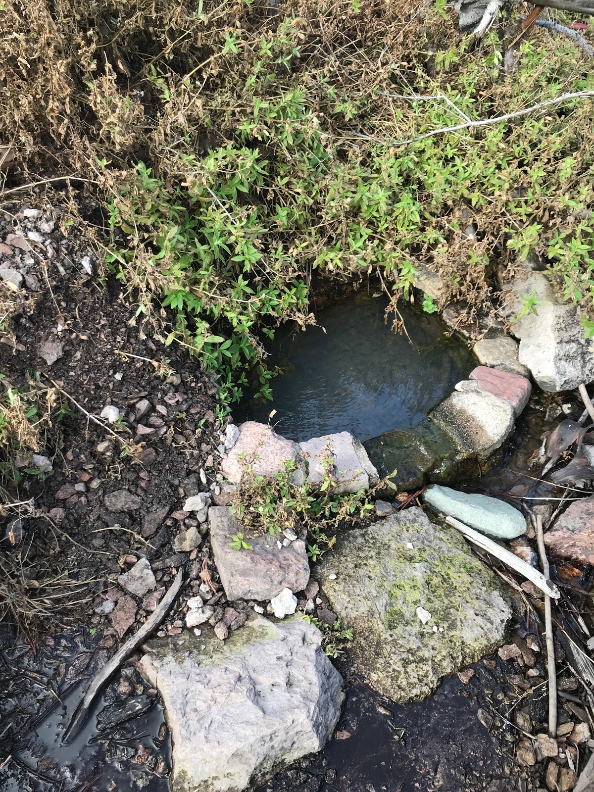
Another note, most if not all shelters have a spring. Finding water is never too hard. Getting to the spring can be hard because it’s usually some drop or climb to get to it.

For dinner I had some Pasta Roma dish in which I added too much water. Nothing worse than drinking your dinner.  We finish eating in the dark. We pack up our food bags and put them on the bear cables. No tossing a bear line or hanging food on a bear pole. These are legit steel cables specific to hanging food to keep the bears away.

Its after eight when we crawl into bed. The forest sounds are loud tonight. I fall asleep.

Day One by the Numbers:

Miles 6.47

Time Hiking 4:00  Total Time 4:00

Elevation Gain 2615 Elevation Loss 712

Calories In 2260 Calories Out 3584

Max Temp 77° Min Temp 53°


Day 2 (Sunday)

We wake up late. Who am I kidding? I was awake, but really had no inclination to get out of bed. Warm and cozy, slight swing, cloudy outside. You would do the same. When I do get up, I make some coffee and some hot oatmeal multi grain bowl. Really good.

The whole campsite is fogged in. We take our time and we are the last people to leave camp. Its almost 10 AM. I am anxious to get moving. I tell Mike he can catch up to me or I can meet up when I stop for a break. Again, like yesterday, it’s a slow climb but the haze and fog lifts and the sun shines through the trees. Feeling really good, I catch up and pass two women who were in camp with us and left before us. That makes me feel even better. 

So far, I have not said too much about the scenery. That’s probably because there is not much to say. I could be in any forest in Wisconsin for all I know. The foliage blocks most of the views we would have as we continually climb in elevation. In early spring or late fall it might be different, but so far, this a walk in the woods. 

I eventually make it to Mollie’s Ridge Shelter.  Off with the pack and get at some lunch. (any opportunity to lighten the pack!) I go down the hill for some water at the spring. Two other gentlemen that stayed at the site with us last night are finishing up their lunch as well. John and Gavin. They have done the trail before and usually try to get out at least once a year for a longer distance hike like this. I find out we will be in the same shelter tonight so I will see them later. They leave and I wait for Mike. The ladies I passed come in, then another group of hikers from another direction roll in. Where is Mike? Finally, he rambles it. I know he likes to shoot video and pictures, but I have been here over an hour. We chat a bit and I let him know I will head out and we can catch up at the next camp where I can grab a site for him.


I put my outer shirt on, then my pack. Back on trail. It’s another 6 miles to Spence Field Shelter. The weather is great sunny, no bugs, it’s pretty easy going.

I roll in right around 5 PM. Gavin and John are already there as are 3 other couples. I find a site with 2 trees and a pretty flat spot for a tent. This will work. Being last in camp you don’t have many choices. Mike arrives and we have dinner. All the hikers are around the shelter and because there is much more daylight, we have time to sit and join the evening discussion and storytelling. It doesn’t take too long before the sun starts to set and a chill creeps in. We hang our food and hit the hay. 

Day Two by the Numbers:

Miles 11.77

Time Hiking 5:06  Total Time 6:47

Elevation Gain 3215 Elevation Loss 2037

Calories In 2453 Calories Out 4482

Max Temp 78° Min Temp 48°


Day 3 (Monday)

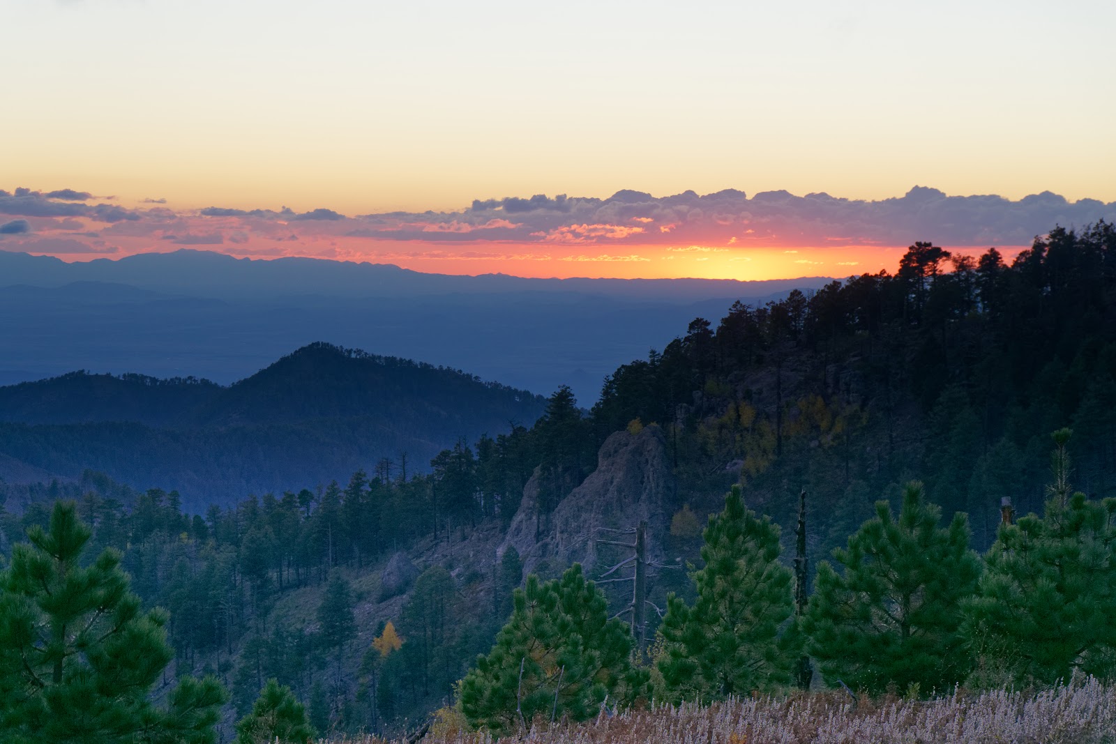
The wind picked up last night and I woke up a few times due to some gusts. Really re-thinking my lightweight quilt choice. By 8 AM the camp is up and humming. People eating, packing up and getting water. Standard camp chores. Again, we are the last out of camp. Today we finally get to see some views. The wind cleared any remain clouds out and the morning out of camp is glorious and clear. On the trail I notice there is a good hard frost on the grass. Yep it got cold last night.

 A little over a mile out of camp we hit the famous ‘Rocky Top’. You may know the song. The views are great in every direction. We take a lot of pictures and it gives me a sense of accomplishment, finally seeing some things for the 20 miles of effort.


The next spot is Thunderhead Mountain. Talk about opposite of Rocky Top. We would have missed it if not for the USGS Disk on the ground. Socked in with vegetation. 

We work our way to Derrick Knob shelter for lunch. Again, we have caught up to John and Gavin. They are staying at Silers Bald Shelter tonight. We are going further to Double Spring Gap Shelter; the rest of the day is pretty uneventful. Silers Bald is another view point in the early spring, not in late summer. 

I get to the shelter as the sun is setting. I have about an hour to set up and eat to beat the dark. This site has 12 people tonight. The max. A few are really ambitious as they try to make a fire. This late in the season all the wood has been picked over, or is rotten and wet. It’s mostly smoke. Mike and I make it past dark chatting for a little bit. Again, hang the food and off to sleep.

Day Three by the Numbers:

Miles 14.2

Time Hiking 7:00  Total Time 8:37

Elevation Gain 4314 Elevation Loss 3802

Calories In 1993 Calories Out 5130

Max Temp 66° Min Temp 38°


Day 4 (Tuesday)

Today is different. We are out of camp before 9 AM! We were trying for 8:30 but 8:45 isn’t too bad. Two reason for the early start. Today will be the longest day so far day and we might be meeting Mike’s Uncle at Clingman’s Dome so hence the reason to get an earlier start. Today we also hit a few high points of the trip. Literally. Clingmans Dome is the highest point on the Appalachian Trail at 6684’. It takes us less than 2 hours to get to the paved trail where all the tourists are plodding up the hill. We get to the observation deck (which has a UFO like appearance) and walk to the top. 360-degree views and a perfectly clear day. This is actually my 4th time to the top of this look out. Its still cool all the same. We come down from the observation deck and decide to walk down to the parking lot to get rid of some garbage (weight reduction!), use the restroom (weight reduction!) and see if the tourist center has any snacks for sale. Mike is really jonesing for diet Coke. Sadly, COVID restrictions have it limited to park merchandise and a few candy bars (which I purchase two). We chat with the Park ranger for a bit then head back up the paved tourist path. 


We meet up with the trail where we jumped off and get back on. Running into a few of our camp mates form the night prior. 

Today seemed a bit harder. Not sure if it was just the few days catching up to my body? Maybe it was the trail. Mike and I were hiking together for quite some time, when I hear a short “Ahhggh!” I turn to see Mike on the ground. He had just twisted his ankle of some particularly rocky part of trail we were on. He’s ok, has some pain and weakness, but we continue on. 

On this trail water is pretty easy to get and this afternoon we were going to fill up at the Mt Collins Shelter as it was around our halfway point. When we get to the side trail for the shelter it states it was more than a mile roundtrip (with a lot of up and down no less), we decide to pass and try our luck at a possible source a bit further down and much closer to trail. When we get there, we see a wet path and some seep from the rocks, but nothing that will be easy to gather. Luckily, we search a little further and find the source, trickling out of a rock, much like a faucet that was left running. We fill up, eat some lunch and Mike takes some Advil to ease the sore ankle.

The next stop today is Newfound Gap the highway that bisects the park and major tourist attraction. Today is no different. It’s packed. We take some pictures, take a break and then get back on trail. It’s 3 miles of almost all uphill to our campsite. 

It’s a long day when we arrive at Ice Water Spring shelter. It’s a nice site, views and clear skies for the evening. Unlike most shelters, this is not buried under some canopy of trees. We set up camp, eat some dinner, chat with the other guys here and go to bed. Mike’s ankle seems ok, but the more he lets it sit the tighter and sorer it gets. 


Day Four by the Numbers:

Miles 15.31

Time Hiking 7:44  Total Time 9:30

Elevation Gain 3894 Elevation Loss 3478

Calories In 2108 Calories Out 5279

Max Temp 79° Min Temp 39°


Day 5 (Wednesday)

The night wasn’t too cold nor too damp, so I slept pretty damn good. That’s the thing with these trips. It takes a few nights for your body to acclimate to the new sleeping arrangements. But once it does its not too bad. I woke up made some breakfast and instant coffee. That was super disappointing. I had brought enough pour over coffee for the whole trip. The issue is my collapsible cup got a hole in it, so I was down to one pot to hold water and hence nothing to pour the coffee through and into. At least I had some back up.

Mike rolled out and tested the ankle. Sore and weak, clearly sprain symptoms. It’s causing him some pain and probably not going to get him 31 more miles. It’s his choice to continue, but this is also the best place to get out if he can’t go. Newfound Gap is only 3 miles back and his parents can pick him up easily. If he tries to continue there are no more outs s easy as this. He makes the right call and then calls his Dad to schedule a pickup. Mike and I exchange some items (I left all my cables to charge my phone and inReach in the car). We wish each other good luck and we go in opposite directions. 

I have done plenty of solo trips so I won’t have any problem with finishing the trip. I just feel bad for Mike, he was looking forward to this for so long and now he can’t finish it. 

The sun has disappeared behind a gray sky. There are a lot of day hikers out today. Having easy access at Newfound Gap is a reason why. The other reason is Charlies Bunion. Its less than 2 miles from camp, making it an easy out and back for many. Charlie’s Bunion is a rocky outcrop near the summit of one of the mountains. It’s a tourist spot and people are lined up waiting to climb up, look at the view and take pictures. I drop the pack and do the same. All week-long, day hikers and tourists alike always ask if I am through hiking the trail. I always answer, yes, I am though hiking the Smoky’s. Then they ask if I will do the whole trail and need to explain that I still have a job


The rest of the morning is uneventful, I sit on the trail and have a bit of lunch. The next shelter I am slated to stay at is Tri Corner Knob. Until then I need to get water again. Like the other day I was going to get water at a shelter, this time Pecks Corner Shelter. Also like the other day it’s more than a mile round trip to the shelter and back to trail. I start the walk down to the shelter and see some water trickling off the side of some rocks. I improvise a leaf to channel the water into my container. Its super slow, but sure beats 25 minutes of extra hiking. 

The rest of the day is pretty boring an occasional great view, but much of the same we have seen all week. Seemingly ancient temperate rainforest.

I roll into camp and the shelter has 6 people in it. I say hi and go find a place to hang the hammock. Once that’s done, I change clothes and walk back to the shelter for dinner and chat with a completely new group of people. 

This group is all older. By older I mean in their 60’s or perhaps even older. Four of them are local and do they have the stories of the park. How the dams were built, how people were removed from the park when it became national park. All the secrets; homesteads where stoves and chimneys may still stand. Family graveyards that are all over the park and so much more. They tell the stories and I just listen. 

It slowly gets dark and we all retire for the night. There is rain in the forecast for tomorrow afternoon. I can’t complain, we had 5 days without any bad weather and for me that’s unheard of.

Tomorrow afternoon happens much sooner. More like 11PM and  I am awoken by rain drops hitting the fly. I start thinking if I left anything out, yep. My hat is now getting soaked, as I had it hanging to air out when I came into camp. I reach to get my water bottle under my hammock and take a drink. I am hanging on a pretty steep slope so when I put the bottle back, I slides and I hear it roll down the hill. Perfect.

Day Five by the Numbers:

Miles 13.1

Time Hiking 6:07  Total Time 6:28

Elevation Gain 2900 Elevation Loss 2917

Calories In 2011 Calories Out 4133

Max Temp 63° Min Temp 45°


Day 6 (Thursday)

Well the rain has not stopped. Its not hard, but it is steady. I lay in bed not wanting to get up because is chilly and damp. I eventually work my way to the shelter eat some breakfast and say goodbye to my campmates. 

I have a few options today. My permitted shelter is over 16 miles away. Davenport Gap. There is another shelter that was closed due to bear activity when we secured our permits but has since been re-opened. That would make it an 8 mile day. Decisions, decisions.

I pack up under the tarp and then finally put the tarp away, trying to stay out of the rain as long as possible. 

Surprisingly I am in a pretty good mood, even though my feet are slowly getting more wet. Especially when you walk though tall grass that just dumps all that moisture on your legs and into your socks.

I am cruising today and get to Cosby Knob Shelter before noon. The signs are everywhere. Caution – aggressive bear activity - a fed bear is a dead bear. I get under the shelter and strip off my rain jacket. Put a warmer shirt on. Trying to dry out a bit, I take my shoes and socks off. I mean why not I will be staying here for the night. 


A couple I stayed with last night roll in as well to take a break to have some lunch. They only have a few miles and take a side trail to where they left their car. We chat as we are both eating and eventually, they leave.  

I am sitting here in my thoughts, rain just pounding on the metal roof of the shelter. Am I really going to sit here damp and cold for the next 6 plus hours while I wait to go to bed? Should I start a fire? I could sleep in the shelter (uncomfortably). Just me and the bears and mice.

Nah. I stuff my feet back into those cold-ass socks. Back in those damp shoes. Repack my bag and grab by raincoat off the drying hook. Way too much daylight to sit here. Plus, when I make it to Davenport Gap Shelter, it will leave me with a 3 mile day and not a 9 miles day tomorrow.

I leave Cosby Knob with the rain coming down nice and hard. Good. Bring it on.

About 2 miles in I come up on the Mt Cammerer look out trail. It will add another one and a half miles to my day. The Guthook trail guide says it’s well worth the effort. I think to myself. Its only miles, you may never have this chance again. Why am I even debating this with myself, out loud. I take the fork to the left and head to the look out. This trail is muddy, steep, rocky and slippery. I have to climb up a few spots of granite. The rain and wet does not help.

Eventually I see it, a dumpy little building. I climb some more granite and get to the little stairway. I can already tell my choice to come here was a good one. The views are amazing, the rain has stopped. The clouds swirl though the valley below me. 

I jump into the creepy building take off my pack and get the cameras out. I walk back on the 360° deck and just soak it all in. I am not religious by any means. However, it felt strangely spiritual, in a one with nature, type of way. 


I grabbed a snack in the dryness of the building and look out the window. Still feeling it.

Completely re-energized, I leave Mt Camerer Lookout and bound down the trail. (Until I almost fall several times on the slick rocks). Tempering my enthusiasm just a little bit I get back to the Appalachian Trail and continue my journey.  The rest of the day is mostly downhill. That’s hard on the knees and treacherous with the rain. About 2 hours later I am nearing the Davenport Gap shelter, I am making incredible time. It’s not quite 6 PM. I still have over an hour of light left.

I pause at the fork to the shelter for the night. Again, decisions to be made. Go set up in the mist and spend one more night here, where I can clearly hear Interstate 40 traffic? Or pound out another almost 3 miles and complete the trip a whole day early? 

It doesn’t take long before I am down the trail and letting Mike know I will need a pick up around 7:15 under I-40. 


Giddy with exhaustion, having wet feet that are starting to feel signs of blisters from wet socks. I narrate the remainder of the trip to myself. I finally slip enough and hit the ground. I just laugh. It took the trail all week to get me down. It was going to happen. Just can’t believe it took this long. The trail follows a stream that grows into a river and that finally dumps me and its contents on a bridge to the Pigeon River. Unceremoniously, I am out of the park and done with this walk in the woods. That’s it. 80 miles and 20,000 feet of elevation gained and lost. So much planning, one false start in July and now it’s over. Proof that sometimes the journey is better than the destination.

Day Six by the Numbers:

Miles 19.1

Time Hiking 8:08 Total Time 9:25

Elevation Gain 2412 Elevation Loss 6752

Calories In 1623 Calories Out 4665

Max Temp 56° Min Temp 42°


Epilogue, (sort of).

Mike picks me up with a small cooler of beer as I requested. A hand selected assortment of local micro brews. I grab one and throw everything in the car. We head toward the airport. In seconds I am on the phone booking a room for the night. 

I get to the room, drop my gear and take lovely, long, hot shhhhhower. Trail remnants circle the drain. I come out and Mike who is waiting to take me to dinner asked if I had anyone in there because I must have made lots of ‘ahhh’ sounds in the shower. Hey, sometimes it’s the little things.

We get burgers and beers and after 6 days on trail it was delicious. 

I try to alter my flight to leave the next day, but the cost to change is more than the cost of the whole flight itself. The next day Mike picks me up for lunch and some sightseeing. Sadly, much of the sights are socked in with clouds and rain. I have known Mike a long time (over 20 years). We have done quite a few of these adventures and to his parents I am just a myth. Until now. We sit and chat on the screen porch for over an hour. I hope I let them know how much I appreciate them accommodating us with the car drops and pick-ups.

What’s left? Dinner. North Carolina BBQ. Ribs, pulled pork and smoked wings. Enough said. I would come back just for the ribs. 

Mike and I talk about the trail, how we both felt about it, and what the next trail we can do. 

The next morning it’s a 5:45AM shuttle to the airport. The week ends just the way it started.  Although now I am anxious to get home instead of back on trail.


FULL PHOTO ALBUM ON FLICKR or JALMBUM


Friday, November 2, 2018


I am beginning to think someone has it in for me when I try to do some epic hikes, especially when in Arizona. It won’t stop me from trying though. 

VIDEO
PHOTOS
New Album

As I get closer to the big 5-0 I wanted to do a more rugged multi day trip. After researching I decided to backpack in the Chiricahua Mountains of South Eastern Arizona. Rugged, yep. Remote, check. Challenging? Absolutely.Another reason for this was to spend some extra time with Mackenzie as my base of operations would be Tucson. Win-Win right?


In the week leading up to my trip I start watching the weather. Lots of tropical storms coming out of the Pacific and going across Mexico touching off all kinds of flooding in the Southwest US. A few days before leaving I see that there is rain forecast for the area I will be in, Saturday and Sunday for sure. It’s hard to get accurate forecasts because where I am headed there are few weather stations. But it also looks like it will be cold and very windy.
This just means I have to add to my pack. Rain gear, bigger tarp with doors, warmer sleeping bag and additional warm clothes. Normally it would be in the 60’s I was going to be 40’s or lower. Not really happy about it but I can’t change my travel plans this late in the game.
This originally was going to be a solo trip, just me. Tracy talked me into having her tag along (not on trail) just to spend more time with Kiki and hell, to be out of Wisconsin again.
We had a very early flight on Thursday morning and we were in Tucson before 10 AM. Did some pre-hike errands and picked Kiki up after her class and went to lunch!
We hung out and Mackenzie stayed with us as she had no class on Friday.
On Friday morning I left around 8 AM and had an hour and forty-five-minute drive to get to the trail head. I was also planning on stopping at Johnny Ringo’s gravesite. If you’re not familiar with this particular ‘Cowboy’, the 1993 movie Tombstone brought his character from somewhat obscurity to infamy. His grave is on private property and the landowner is gracious enough to allow the public to come to the site. I thought it would be fun as it was on the same road as where the trail was. 
When I pull up I see a cowboy. No, not just any cowboy, Johnny Ringo himself. I approach (cautiously, he’s going heeled). He asks me if I’m here for the vendetta ride. I politely tell him no. I have serendipitously came to the site on the one day of the year they are doing an event. This gentleman plays Johnny Ringo, in the city of Tombstone and other places. He shows me the site like a personal tour guide from beyond. We share a few movie lines and I am giddy like a kid on Christmas. After a few pictures handshakes and hat tips, I head down the road.


This road, by the way, is dirt, 10 miles of dirt. In a rented Chrysler 300s. Flashbacks to other trips.
This is national forest or BLM land and is rugged as such, I drive for some time and never find a sign. I turn around find a sign but no place to park. I find a place to park but it’s not that close to the trail. I have no idea if I can even park here. I get all my stuff ready put a note on the dash and walk to the trail. I have not seen a person since Johnny.
Its 11 AM by the time I get to the actual trail. Mormon Ridge trail. It’s going to be slow, I have over 3000 feet of elevation to gain. I think I am mentally prepared for it. I think I am physically prepared for it. The temperatures are mid 50’s and the sun is shining. So far so good.

There are some ‘hitches’ to this whole trip. One is water. I can only carry so much and there may or there may not be water in the springs I have mapped. People have said last year’s snows were light and snow is really what feed springs. Because of this uncertainty, I only allow myself to drink half my water for the trip up. This way if I cannot locate water I have exactly half to get down. This makes it tough as the climb is hard and I know I am expending much more energy than I would coming down.


The elevation going from 6200 feet to 9700 feet for a Midwesterner also plays into the effort. I am just not used to the elevation.  
I know I may have mentioned that this is very rugged area. The trails are not well maintained. I don’t even mean in the way that a crew comes and keeps them from fallen trees and overgrowth. These trails see very little traffic at all. At times I find myself having to really look for them, it’s just not obvious.
The day goes by slow I am averaging under 2 miles an hour. But as I climb out of the valley the views get better and better. All of the sudden a thunderous roar can be heard and almost instantly 2 military jets (F16’s I think) come screaming over the peak and down the canyon. It’s so loud its almost scary. I tried to get a video of them but I was in some trees and the second time they came around I was too late.
It energizes me for a while. The adrenaline surge only lasts a little while and I am back to a few hundred feet, take a break. Repeat.
About 2 pm I reach my first trail crossing. It’s not so much a crossing as a wore our sign and a trail that goes in a different direction. I have GPS AND Map and am glad for it. What I thought was a trail on GPS was a no go in real life and the map showed me my other options. Thankfully I had options. Basically, a long switch back that finally got me to the main trail at the ridge-line. The Crest Trail. This is the best trail as it connects all the others at the top. It’s the main artery to all the side and feeder trails. 
The plan this week was to camp near this trail and day hike to all the other peaks in the area topping out at 9800 feet.
Feeling relived that the terrain will flatten out for me as I am near the top I focus on water. I start looking for a side trail for the water. Again, the trails as so faint and the signs are worn, fallen down, pointing ambiguously or some combination of those traits.


I eventually find the Anita Park spring trail and start looking for said spring. It’s a steep descent, so I shed my pack and decide to look for water without it, no sense in dragging that around if there is nothing. Again, there are no markers, just wilderness and downed trees. I point myself in the right direction and listen. Shhhhhhhh….I hear a trickle. Just like meeting Johnny and seeing jets, my adrenaline spikes. I work my way to it and see a small lovely brick lined pool. It holds the water, fills up and trickles over. I am so excited. I know I will be ok with water and my trip can continue.


I hike back to my pack. Drink all the water I had. Then grab my empties and my additional bladder and fill up on cold clear mountain spring water. Water is life. I felt alive.
I donned my pack now with over eight extra pounds of water. 134 ounces to be exact. No one is going to be thirsty tonight. Plus, I would need it for breakfast and coffee! No need to take less and have to make more trips for water. A small penalty to pay.
Now I had about 90 minutes to find a camp site before sun started setting. This is another ‘hitch’ I am on a mountain. Flat sites for tents are rare and so I have my hammock. No flat ground needed. Except the mountain has had had two separate forest fires in the last 10-12 years. A lot of the large trees are gone. Even of more concern is the dead ones still standing. I hiked until I found a perfect spot. Flat and nice trees with very little dead still standing to be concerned with. So far, the weather has been great, I am very optimistic, however I know the forecast for rain and wind is supposed to hit at around 3 AM.
This site had obviously been used by others as well, a rock fire ring was there and a log for seating as well.
As I set my hammock up the wind started picking up. I did my best to really batten down the tarp the doors and fortified the stakes by putting rocks over them so not to pull out in high wind. I finished unpacking, changed into some comfortable clothes and ate the other half of a smashed subway sub I brought for lunch. I did not bother with any other food and like every time I backpack, I know I have brought way too much food.
I hang my food bag. Yes, there are bears and mountain lions so I prefer to keep my food as mine.

All of the sudden I realize the sunset in incredible. I can see for miles and the world just drops below me. The moon is up and all is good with me.


The sun finally sets, and darkness settles in. It’s too windy to have fire and I don’t want to be the cause of another forest fire on the mountain. Around 6:30 I settle into my hammock and pull out my Kindle. Another hiking luxury, but it is so nice to just relax, read and eventually drift off to sleep.
It doesn’t last long. Two hours later the wind really picks up. You can hear it just roaring up the side of the mountain, then the sound stops then it hits my campsite. At times I think I will certainly have the tarp ripped away, it’s that bad.
I fall in and out of sleep and around 10 I need to pee. I slip my shoes on and step to the doors of my tarp. They are soaking wet. But it’s not raining? I mean it’s wet on the inside and the outside. As I step through the door I turn my headlamp on. Clouds. The clouds have settled on top of the mountain and are staying put. I can see the finest of mist in the headlamp beam as if it were a steam room. It permeates everything and there is nothing I can do. I am thinking to myself with the wind so strong these clouds will get moved out by morning. Wishful thinking indeed. I climb back to bed. The mist is held at bay by my tarp and the netting on my hammock, so I stay mostly dry. It’s a night of sleeping, waking to wind and eventually rain.
Only once during the night did I have to fix a door that had been pulled free of its stake from the wind. The flapping was like a tattered flag. I quickly got up to fix it. I was rather pleased with myself as the rest of my set up held the rest of the night.
Around 4 AM, I begin hoping the sun will be up in 2 hours the clouds will burn off and I can dry out eat some breakfast and spend the day as planned. Again, I know, based I a forecast I pulled with my satellite communicator, this weather is here to stay.
The time for sunrise happens but I can’t tell for certain. I remain warm and snug but realize I can’t stay here forever. My hammock is so wet with mist it is running from the netting and starting to soak into the main body where I lie. I can feel it. At this point I could stay but it would be ‘less than optimal’ and with not much to do but lay in bed, possibly get wetter and really set myself up for some bad times. In my head I know what has to be done, but my heart is not happy about it. Many months of planning and cutting my trip short by two thirds. I mean I worked my ass off to get up here. I was not going to get to enjoy it.
I stripped out of my sleeping clothes, put on my rain paints and rain jacket and went and grabbed my food bag. I wasn’t even going to have coffee. The wind and rain were just to going to allow any of it. I had a protein shake (420 calories in an 8 oz drink!) to get me started and I proceeded to breakdown camp.
Breaking down in the rain sucks, breaking down when everything is wet and the wind is a constant 20 miles per hour is a whole ‘nother level of suck. Leaving my tarp for last to give me as much shelter as possible, I cram it into the stuff sack, then squeeze it. So much water comes out, all I can do is laugh.
I drink a lot more water, refill my bottles from the bladder of spring water. Sadly, I dump 2 liters of it out as I won’t need it.
I hoist my pack on my back. It is the heaviest it’s been. The water-soaked tarps and such just add to the misery.
Determined to make the trip a little more than an out and back, I decide to go down a different way than I came up.  The trail would pop me out almost the same place I came in so, hey let’s see some different stuff.
I begin my walk around 8 AM and its comical. The wind is so strong, the mist so thick. It takes all the help my hiking poles can give to stay up right at times.
I take the Crest Trail North until it meets Round Park and splits for Saulsbury Canyon (my trail) or heads up to Fly Peak. Fly peak, one of the 6 or so peaks I was supposed to get this weekend. Sigh.
Saulsbury trail is not marked, it is faint (game trails are more worn) and it has not been maintained in years. I decide to start counting the trees in the trail that I have to circumvent, crawl under or climb over.
Despite the howling winds and rain, I make pretty good time. Until I lose the trail. All the trees down made me estimate where the trail was, in a general direction. I lost the trail at least 4 times and had to bushwhack over what might have been a trail or might just have been mountainside. I slip. I slide. I twist and turn. Look at the map get a general bearing and keep walking. All of the sudden there is trail again. I look behind, nothing. As if it was just laid in front of me.
It’s frustrating at worse, comical at best. Crossing talus slopes where no trail would stay long anyway due to the nature of the rock itself, I continue and point myself in what I deem to me the right direction and sometimes realize the trail is now above or below me. How the hell?  I know I am not the only person when I find a fleece jacket snagged on some overgrowth. Someone else with the fleece tied to or loosely tucked in a pack took the same ‘trail’ I did and left me a marker.
I eventually get out of the clouds. Some blue sky in the distance but the mist and wind still tendril down the mountain as if trying to bring me back.
At this same time, I lose the trail for the last time. Some thoughtful hikers put some cairns up but as I follow they abruptly stop. At this point it no longer mattered. The map had the trail going up and around. I was pointed to the trail just on a more direct route. Like a jaywalker I cut across, making my own way. I spook 2 deer who just bound away, never even letting me ask for directions. Deer can be such jerks.
On my way down, the sun is out in full. Of course it is.  At this time, I half thought to just stop and camp for the day and salvage some of the trip. Again, I was wary. I knew the weather was still looming. Showers, thunderstorms more wind.
I find what I call a little drainage cut and follow it down to meet the trail at the end of my jaywalk. Like climbing down a large rock ladder. A few seeps of water made it slippery. Difficult is a good word. I am testing every footfall so as not twist or sprain or fall. It is a beautiful place but I don’t want to have to be extracted. I reach the bottom and there it is. Nestled in some pines and a carpet of needles, the trail! My little gamble paid off.

From here on out the trail follows a small canyon. Its quiet and a small stream appears. The trail crosses it several times. I come across a huge tree. I decide to have fun and climb over this one. My tree count I started was now in to the 80’s.  I continue to follow the trail into a forest that eventually turns into a field and then a vehicle path, a dirt parking lot. I am off the mountain.  I cross Turkey Creek one last time and see the car.  I end my walk at 103.


At the car I get out of my rain pants. They are shredded. All the little slips, sharp rocks and overgrowth have taken a toll on the nylon shell. I also have a nice scrape on my right butt cheek, a huge bruise on my shin and cuts and scrapes on my hands too numerous to catalog. A fun little motto of mine applies ‘No good time comes cheap’. Be it monetary or physical it almost always seems to play out that way. 
I change into a T and shorts for the drive home. As I stand half naked a car pulling a pop-up camper comes up the primitive road. They ask me for directions to the campsite. I tell them it’s further up the road (it is). It’s the first people I have seen in 36 hours. I probably wouldn’t have seen anyone if I had stayed on the mountain.

I drive back to Tucson. I look back at the mountains. The clouds still sit atop the peaks of the range. Nope, I made the right call.

It rains or storms every day we are there. It’s very strange weather for the area, everyone is telling us the same. It’s quite possibly due to the category 4 hurricane Willa that had just come off the Pacific and over Mexico. It just could be my luck.


Wednesday, December 27, 2017

Havasua Falls!

Sitting at Mom’s house eating to excess. It was Thanksgiving. However, that meant tomorrow Joel and I would begin an adventure 9 months in the planning. One of bucket list proportions.

Day One

(Black) Friday afternoon Joel and head off to the airport for our flight to Las Vegas. Logistically, this made the most sense to be our insertion point. There were a few other options, none with availability or discounts for airfare and accommodations that Vegas could offer. Honestly, I enjoy the planning of the trip way more that someone should.

We had an uneventful flight into Vegas and took a Lyft to our first hotel of the trip. The Westin. Off strip, no casinos, no bullshit, just simple but comfortable rooms.

We dropped our bags and did some sightseeing. Typical Vegas stuff, see the themed hotels, casinos, restaurants and take some pictures.

Being quite hungry we decided to eat at Guy Fieri's Vegas Kitchen. Partially as a joke, partially curious.

Surprisingly the Mayor of Flavortown did not disappoint. It’s a higher level of bar food. Big burgers done to order although a bit over the top with some of the toppings, but tasty none the less.  I expect nothing less than extreme from Guy. The side of fries were a bit of a letdown. A mix of skinny, fat, waffle, and other cuts of potatoes. Kind of felt like when you have 3 partial bags of ore-ida frozen potatoes and you cook them all up at the same time.

I also had a jalapeño margarita. Chili salt on the rim, pepper slices in the drink. The waiter explained ‘It was pretty hot, just so you know’. I bet this gets sent back a bit. It was spicy but nothing to be afraid of.

A few more Vegas-y things like the fountains of Bellagio and we headed back for the night.

Day Two

Saturday was more of a move from base camp to our next site in prep to actually get to the trail.

We slept in, went to a little breakfast place that made gourmet egg sandwiches, Eggslut. They had a line, they were a bit pricy but yeah, they were really good. I mean tri-tip and chimichurri sauce on my egg bagel? Absolutely.

We packed up our stuff, got a ride back to the airport so we could pick up our rental car. A fine Hyundai Sonata, one of the finest off-road vehicles if you occasionally need it. (See my Saguaro trip for explanation).

From there we hit REI for a gas canister, since it’s illegal to fly with cans of pressurized iso-butane, whatever…

We found a Target for additional comestibles. Fresh-ish food, water and snacks (Fritos!). Lastly, we hit the ATM for a little scratch because the reservation isn’t much for debit or credit cards.

By this time its near lunch time and well we were hungry again. We had lunch at a local (as in way off strip, city of Las Vegas proper) place called Honey Salt. An interesting menu of brunch type items. Joel had breakfast nachos. Yep, tortilla chips, cheese, avocado, salsa, peppers topped off with two eggs and crème fraiche. I had a grilled cheese and bacon sandwich and a side of tomato soup. Sourdough bread with bacon crumble baked in on top of it. The soup was excellent.

After our second breakfast it was time to really hit the road, for reals. We had a three and a half hour drive ahead of us to our next ‘camp’ just outside Peach Springs, Arizona.

It was an easy if not bring drive on some interstate and about 60 miles of good old route 66.

We got to the Grand Canyon Caverns Inn at 5:50 PM. (we lost an hour due to crossing time zones as well). Checked in just as they were shutting down for the night. After 6 we would have had to call the on call person I guess. We also did a quick stop at the little store for some mocha-chocs bullshit coffee drinks as I will need my caffeine fix tomorrow morning.

I know I am spoiled when it comes to hotels. When travelling for work, I am spoiled and that has carried over to my personal travel as well. This place is a throwback. One of those road side motels where you park right outside of your room type places. We get to the door, use the key (real key, not some key-card) and walk in. She did not disappoint. Cinder block walls, linoleum floors (cold) 6 channels on the TV, no cell service. Joel immediately called it the murder room. I had to laugh as I thought it too. But in the middle of nowhere you get what you can get, plus it builds character.

This evening we unpacked everything made sure we had everything we needed and wouldn’t forget anything. Also leaving some things we probably wouldn’t use. We both took what would be our last shower for the next four days and went to bed.

Day Three

5:00 Am came early as it tends to do. I never sleep well one night in a hotel and with these beds, this was no exception.

We dressed, had a few quick breakfast items and were on the road by 5:20 AM. Why so early? We still had to drive over 60 miles to the trailhead and my research told me the earlier the start the better. Less heat, less people etc. Made sense, plus more time to relax when we get there.

It was about 6:45 when we got to the trailhead parking lot. We stretched our legs, took a quick walk around (still pretty dark) and pulled our packs out of the trunk. We slowly made our way over to the start of the trail, waiting for the sun to break a bit before travelling down a narrow trail and 2500’ of elevation drop.

A few minutes before 7 we began the 8 mile or was it 10 mile (or more) hike to Supai. The mileage was questionable as they say it’s 8 miles to the reservation, 10 miles to the campsites, but the campsite area is over a mile long, so we prep for the longest and enjoy it if it ends up being shorter, right?

Right off the bat, I knew this was going to be special. This is a feeder to the Grand Canyon and the early morning light was hitting the high canyon walls, it may sound cliché, but almost spritital.

The hike down wasn’t too hard, very dusty as it is also a horse trail. Their hooves beat the soil and rocks to a fine powder.

About two thirds of the way down the initial decent we met a burro and a horse. Wild? Probably not but they could care less, they see people all the time I am certain.

We continue down the trail until we get to the canyon floor. The weather so far is great, temps in the mid 50’s. Not going to sweat, not too cold.

As we hike through the canyon, its just one spectacular view after another. Every turn a different perspective of what we may have just seen. I take a lot of pictures and video, but I know it won’t do it the justice of being here in the moment, but I try to capture it.

Not sure how long we were hiking when we met our first few people coming the other way. I decide to keep count of how many people we pass. It’s something I do almost every hike, especially the more remote ones. Not sure why, maybe it gives me a feeling of solitude knowing there are not too many people where I am.

We hike on more and we pass many more people coming out. The number keeps climbing 30, 50…     Then a huge group of over 30 in one pass. Joel and I stopped counting at 150. Makes sense though, it is Sunday and many people probably are here only for the weekend.

This place gets very busy and it is near impossible to get reservations. I think they have around a daily capacity of around 300 campers. Based on how many people we saw leaving and we were only a few going in, I thought it might not be near as crowded. This was confirmed by a guy we passed who told us ‘You’ll have a great time the place is almost empty”.

Close to three hours into our hike, we finally start seeing the reservation. Houses and horse corrals start to line the path. Eventually we make it to the camp office. We check in, get wristbands, like we were at some waterpark. From here it is supposed to be another 2 miles to the campsites.

We continue through the reservation. There are some schools, a lodge, a church, cafeteria and general store. Oh yeah, and a helipad as well. There are three ways into and out of this place: By foot, By horse or by helicopter.

As we leave the ‘town’ we come around a corner to the first waterfall: Havasua Falls. Joel and I just look at it then at each other, grinning. It’s beautiful. I think we said wow and bonkers. Turns out we would use these works a lot the next four days.

Eventually we make it to the campsites proper. There are very few people here, we have the choice of pretty much anywhere we want to camp.

Since we can be picky we take our time and go back and forth until we decide one, near the end opposite of where we came in.

We drop our packs, and after having them on our backs for the last 4 hours it’s a welcome break. I survey the site, pick some trees and hang our hammocks. Once that’s done we set up a few other things and that’s that. Its still very early. I read you should expect between 5 and 6 hours to get here. We were here and set up in a little over four hours. It’s not even 11 AM.

We grab our water bottles and take a walk back to the spring for drinking water. This is the source for the whole camp.

I failed to mention as you enter the camp there are some small huts. The Fry Bread hut. It’s basically some tarp covered sheds in which you can buy hot food from. A satellite of the cafeteria 2 miles back. You can get this food, If, and that is a big if, they are open. They have hours posted but even that sign jokes about them. They are open when they are open. I assume during the peak summer months they probably stick to the hours and are open often.

As fate would have it, we stopped by after getting water (As it was only about 100 yards from the spring). It was just opening for the day. The woman working there told us to come back in 20 minutes as she had needed some time to prep a few things.

Wait we did, close to 20 minutes on the dot we were back. First the bad news. They were out of taco meat and cheese and beans, so no fry bread Indian tacos. They did have beef rolls, ‘rez’ dogs and fry bread. That’s what we got. First fry bread. It’s fried dough, plain and simple, like something you would get at the state fair. This one came with cinnamon, powdered sugar and a drizzle of honey. The rez dogs were hot dogs cooked in a fry bread ‘bun’ and the beef roll was ground beef  mixed with some corn and chili, wrapped in frybread, deep fried and then topped with salsa.

We devoured all of it. After virtually no breakfast, nearly 12 miles of hiking we were craving the calories. And these where the kind you crave after activity, Fatty Carbs. We left having visions of fry bread later over the next few days..

Sadly, it was never to happen again. They were never open again during our stay. And we looked, several times.

With full bellies and potable water, we arrive back at our site. What to do now? Relax. Joel ‘tries out’ his hammock, I sit and read a bit.

Some of that reading is the rules and regulations we received when we checked in. Also, a map of the area.

The map is set up based on the three outhouses. One at the beginning, one halfway though and one near the need of the camp. A quick little note about these facilities. They are some of the nicest outdoor toilets you will ever encounter. Special composting models that were cleaned daily. Just a little note for those how have aversion to backwoods facilities.

Anyway, I look where we are on the map and realize that we are so far at the end of the camp that we are perhaps only 100 yards from the next major feature. Mooney Falls.

I look up from the map, turn to my left an notice a small bridge near the back of our site that disappears into some brush. When Joel gets up I tell him about the map and where we are. We take a little walk. In less than 1 minute we are at the right side edge looking into the bottom of Mooney Falls. Over 100 foot drop. All we can say is wow.

We take it all in and can’t wait to get down there tomorrow and start exploring, hiking, swimming. It’s only 3:30 PM right now but as we will notice the rest of the time here, the limited sunlight and being almost December, it seems darker and later than it really is. And the sun does set at around 5:00 PM anyway.

We walk back to camp and play cribbage. I picked up this most excellent handmade leather travel cribbage set. I was looking for something different but eventually found this in my search. I emailed the guy and asked him if he was still making them. We would make one for me. It is very cool. Barely larger than the deck of cards itself.

We made dinner and as I mentioned a little after 5:00 PM it is dark. We sit and talk a bit more, going over the plans for tomorrow. No fires are allowed in the camp, so we sit by lantern light. We realize the early morning and all the hiking has caught up to us. Soon we are both hanging in our hammocks reading. Which usually means about 3 pages and I am fast asleep.

Day Four

The next morning we get up around 6:30-7. That’s nearly 12 hours of sleep. I will take that anytime. We proceed to make some breakfast and I attempt to make pour over coffee. I am using this ultralight thing I picked up. It is small and it is touchy. About halfway through I get over zealous with the water and I end up with a bunch or grounds and coffee on the picnic table. I swear. Joel laughs, I drink the partial coffee I made and try again.

After breakfast we pack a daypack with water, food, a towel and extra clothing. Today we descend Mooney Falls and go further into the canyon. Beaver Falls and if we are feeling up to it all the way to the Colorado River.

The left side of Mooney Falls has the terracing and the only way to get down to the bottom of the falls. Ominously there is a sign that says 'descend at your own risk'.

The trail starts down a small passage cut into the face of the cliff. You then pop out for a little bit and again are warned with a sign that this is not easy and potentially dangerous. Back into another tunnel, that exits on the wet and steep slope for the final descent. I guess you could say they were stairs but not really. Foot holds in some places and large chains anchored into the rock here and there. The chains are wet, the ground is wet from the mist of the falls. The whole thing is kind of like a wet climbing wall you might see at some rock climbing places. Eventually you get to some wet worn wooden ladders that are not much better. The whole trip down only takes less than 10 minutes, but the adrenaline is pumping.

We both set foot on the ground at the bottom and turn around. There in all it’s glory is Mooney Falls.

We explore around the falls for a good while, wading around and enjoying this from every angle before we set off to hike the canyon. I also find a basket for carrying a prone person out of this place by helicopter. You know, just in case.

This scenery on this hike is nothing short of spectacular. Words and my pictures can’t do it justice. The high walls, the white-blue water, the ever-shifting light, changing the color and mood on every turn.

The trail itself is moderately easy. We were wearing water sandals and not our hiking shoes. Because you need to cross the river several times this seemed better than watching some people take their socks and shoes off every time. Plus, if we missed a step on a bridge no big deal. There were spots on the trail that were fun water crossings and some spots with sketchy ladders and ropes to climb up and down. We enjoy the walk and stop and admire the beauty at every opportunity.

Finally, we reach Beaver Falls. It’s a large series of little falls completly different than Havasua or Mooney. On the other side of the river on the narrow outcrop is a family (herd?) of bighorn sheep. They are jumping walking around on the small outcrops.

Eventually, they make it to the river and walk across at the top of the falls. It’s very neat to see and the way they look at the people around as if this is normal for them.

Beaver Falls is almost the end of the reservation proper, any further past this point and you were entering Grand Canyon National Parklands.

Since we had a lot of time, we thought we would make a effort at getting all the way to the Colorado River. The problem is we couldn’t find the way down to continue the trail. We saw a trail some 50 feet below the rocks we were on but how to get there? With help of some other people we located a rope attached the rocks and then disappearing over the edge. No one was sure if this was it since it was hard to see past it. If it’s not right it’s a hell of a place to get stuck.

Perhaps if we found a ranger at the time we would have asked. They were dispersed all though the reservation. With notepads, taking names and numbers in the party as well as checking wristbands. As a side note when we did get back to camp that evening I did read you are supposed to notify them if you do go off the reservation so they are aware of who is down there for safety reasons. So it is doable They just probably don’t make it too easy for obvious reasons.

Facing the fact we are not going to go any further today, we start the hike back. During this time, we find a picnic table and eat the lunch we brought.

This brings up a trivial but interesting topic of discussion. How and who got all these random picnic tables this far down the canyon? Were all the materials brought in my hand? There is no way a horse gets down here. Were the materials air lifted in then built wherever? Where the whole tables just brought it? Every time we ran across one in the oddest random spots we had to wonder.

Not quite two hours later we are back at Mooney falls. Time to really get wet. We drop our gear off on a picnic table (of course!). I take my shirt off and we begin wading into the fury of the falls. The water is a bit on the cold side but more so it’s incredibly powerful. It takes a serious effort just to get near it with the force of waves and pounding water pushing you back. I get as close as I can, laughing the whole time at the ridiculous feeling and sound of being so close to this.

I come out and dry off a bit as we ponder the climb back out. I can already feel the bit of anxiety (or is it excitement) as we look at the rock wall. It’s a wet and muddy climb up, but we make it.

We work our way back to camp, change out of our wet clothes and shoes and warm up a bit. So far the weather has been great. Highs in the upper 60’s with lows in the mid 30’s with some sun and some clouds, nothing too extreme. This was one of my biggest concerns on booking this trip so late in the year. Would it be too cold to enjoy any of the water? It wasn’t summer by any means but we were able to enjoy it regardless.

Darkness falls fast tonight. We eat dinner and play some more cards. During a hand we feel rain drops. Over the past hour or so the sky has clouded up and now we get rain? We hustle in the dark to put up our tarps. We originally left them off because we did not think we would need them, sleeping under the stars. We get the tarps up and no more than 30 minutes later all the clouds disappear and its back to near full-moon clear skies. Oh well. We leave the tarps up anyway as the wind did pick up considerably and they help break that a bit.

Day Five

We had an easy relaxing day today and the morning was full sun. The colors and light that came though the canyon at sunrise were spectacular. The water was a kaleidoscope of blues and white changing as the sun quickly moved through the slot canyon.

With the big side trip of the week done yesterday, today we head back to the other large falls, Havasua Falls. It’s not a big as Mooney but it’s easily as breathtaking. Its also much easier to access. The top, bottom and sides are all without the excitement of wet wall scaling. The sun is out in force today but it much cooler. After climbing all over and taking it all in, I attempt to swim in this one as well. Not a chance. The water was much colder than yesterday, almost icy. I thought that with the air temperatures being cooler it might not be so bad, I though wrong. I only got up to my knees before I bailed.

When we were done with this exploration, we were back at camp with lots of time to relax, read, play cards and talk. No cell phones, no people, no distractions. Truly an unwinding.

Dinner time rolled around and we had not one but two meals. We brought extra food and we could eat it or carry it back out. We ate it.

This night was clear and chilly. The moon was almost full, and the stars shone. I went to sleep and woke up a few hour later to look at the stars hoping the moon would have dipped a bit and allowed me to see more starlight. It was still high enough that you could see by the brightness. I went and sat on a table at the edge of Mooney falls. The sound of the water, the clear sky, the cool air. I breathe it all in.

Day Six

Sadly it's time to go back. We get up early have breakfast and coffee (I spill none of it) and are on the trail by 8:30 am. It’s a bit warmer today and this hike is all uphill.

About two miles in we make it to Supai and stop at the general store. I buy a cold root beer and a few candy bars for the trail. I donate the remainder of the gas cannister to the reservation. Better they use it than me just empty and trash it.

Before we continue we visit the little café. We were hoping for one more piece of fry bread. It was not meant to be, they don’t serve that until 11:00 AM.

Joel and I split the soda and head out.

Along the way we are passed in both directions by horse trains. Carrying packs for hikers and supplies and such for the tribe. They funniest thing to see was the large horse train that was for the post office. Those white USPS bins and Amazon.com boxes strapped to these horses was quite a site to see. You certainly get your moneys worth out of a Prime membership this way.

It’s much more difficult that the hike in was, that’s for sure. We take a few stops, drink water, eat those candy bars for some quick energy. Eventually we reach the base of the main ascent. The 2 miles of switchbacks up to the top of the canyon. The sun is out in full and its warming us up nicely just to make it more fun.

This last 2000 feet of up is hard. We pass some people,some people pass us. However, those people have no packs to speak of. One guy confessed that he wimped out and paid for them to carry his pack out by horse. Wimp or smart? At least we can say we did it the right way (PURIST!).

Finally, we reach the top. It takes us 90 minutes more to get our than it did to get down. Relieved and tired we drop the packs, dole out fist bumps, hugs and a few woooos! We did it.

After the short rest we drag our stuff to the car. Change into some clothes not full of sweat and dust and drink a lot of the water we left in the car just for this moment. We look around and take it all in. A few more deep breaths before we start the four plus hour drive back to Las Vegas.

We settle in and play whatever music I have on my phone, because there is still no service. We sing along and talk about what we will eat for dinner when we get back to Vegas. A giant burger? A cold beer? Whatever it would be it would be good.

As we approached the Arizona/Nevada border we decide to stop and quick tour the Hoover Dam. It’s on the way and who knows the next time we would be back this way.

We have about 45 minutes as the dam closes at dusk. We make it an abbreviated tour. Incredible engineering; the structure, the bridge. We had just witnessed so much natural wonderment, now we stood looking at some man-made wonderment.

We eventually arrive in Vegas. This time we are staying at a more typical Vegas hotel. The NY NY Hotel and Casino. It’s a nice place, big rooms and cheap on top of it. We drag our gear up to the room. Take some much-needed showers get dressed in clean clothes and go get the burgers and beers we were talking about!

After dinner we walk around a bit on the strip again (as if we had not walked enough). We hit a little bar for a night cap/celebratory drink.

Day Seven

We both sleep as late as we can. Grab some eats and pack our bags. Of course, before we go we have to ride the roller coaster that is part of the hotel. Joel and I add it to the long list of coasters we have ridden together. Good times.

The flight home was uneventful. We talked about the trip and what we had seen. When we might want to go back here as well as what we could do next for an adventure.....